• Skip to main content
  • Skip to footer

Stone Aerospace

Smart tools and systems for exploring the frontier

  • Home
  • About us
    • What we do
    • History
    • Design philosophy
  • Projects
    • BEAGLE
    • PARTI-Pucks
    • Thor
    • PROMETHEUS
    • ARCHIMEDES
    • ARTEMIS
      • Description
      • Field notes
      • Photo gallery
    • VALKYRIE
      • Description
      • Field notes
      • Photo gallery
    • ENDURANCE
      • Description
      • Field notes
    • DEPTHX
      • Description
      • Field notes
  • News
  • Employment
  • Contact us
  • Stone Aerospace in One Page

ENDURANCE

December 11, 2008 By Stone Aerospace

ENDURANCE: Mission 1: December 11, 2008

West Lake Bonney, Taylor Valley, Antarctica
Reporting from Blood Falls Basecamp

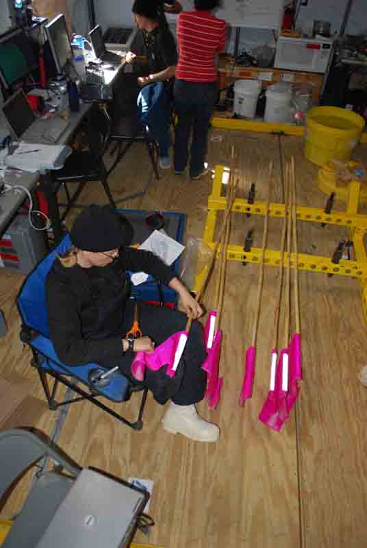
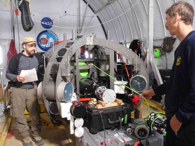
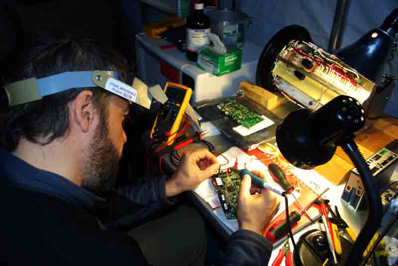
Our successful sonde mission yesterday had us convinced that we were over the hump and would just be running uneventful missions from here on out. Chris, Bart and Kristof took some time in the morning to change the lens and adjust the focus on the sonde camera, so that our images of the lake floor would be crisp.

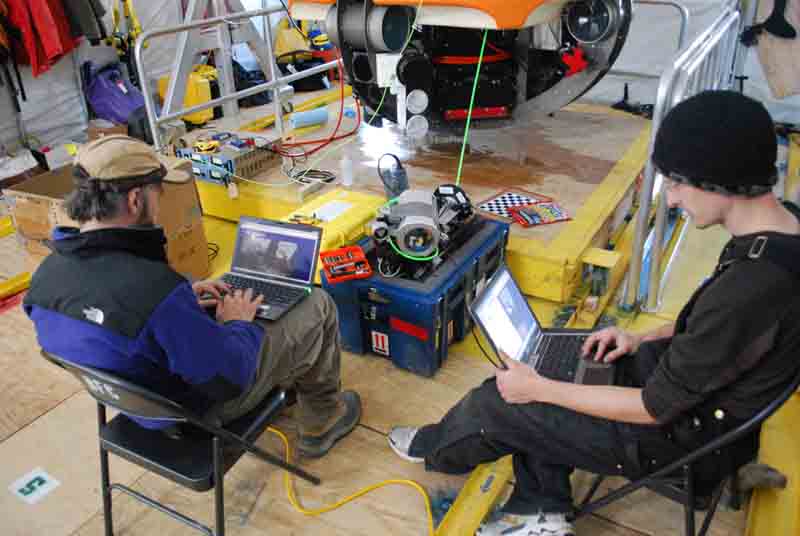
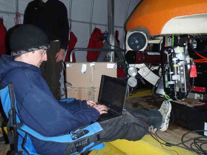
Bart and Chris work on focusing the camera on the sonde.

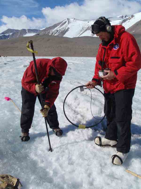
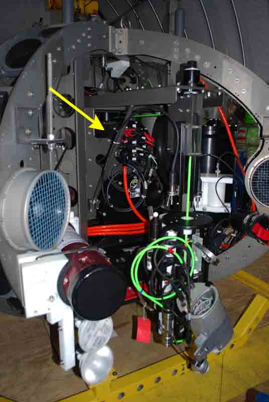
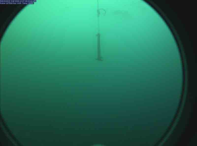
Once they were done, we sent the bot out on its mission for today, nine sonde drops. At the first grid point, we began to lower the sonde but less than halfway down the drop the data coming from the altimeter turned to garbage. The altimeter sits near the bottom of the sonde and tells us how far the sonde is from the bottom as it is slowly lowered. For environmental and hardware reasons, we want to avoid letting the sonde bump into the lake bottom. Normally the sonde is lowered until the altimeter indicates that it is 1 meter above the bottom. Without good data from the altimeter it is difficult to know when to stop the sonde drop and there is really no way to continue the science mission from that point, so we aborted the mission and called the bot home. Strangely, the altimeter resumed normal operation somewhere on the trip home.

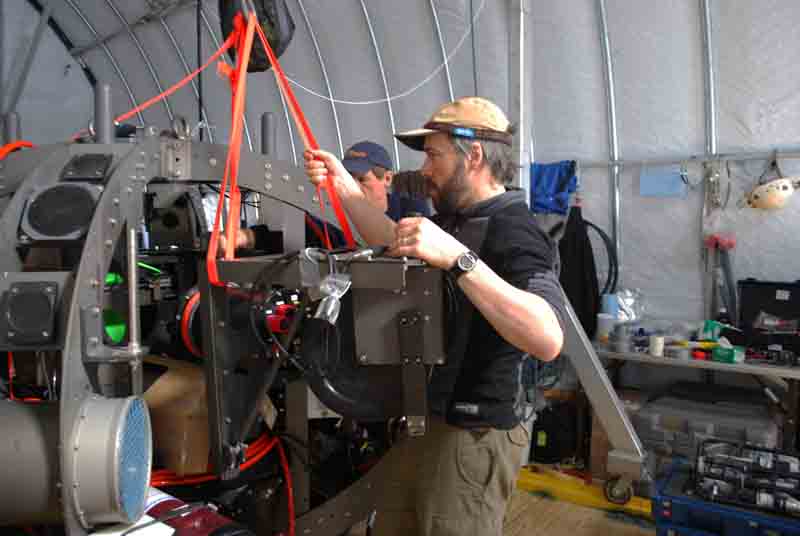
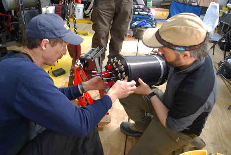
Back in the bot house we started to work on the problem. We pulled the bot out of the water and, thinking that the garbage data might have been caused by a poor communications connection somewhere between the altimeter and mission control, we started to check the altimeter’s connections in the electronics housing in the sonde. Everything seemed fine, and anyhow, the altimeter now seemed to be working. We spent some time dropping the sonde in and out of the water and correlating the altimeter readings to the encoder on the spooler. Coupled with a depth-under-keel measurement from the sonar units, this gives us an additional way to know how far the sonde has been spooled out and how much distance is left as it approaches the bottom. Assuming that we don’t see anymore problems from the altimeter, tomorrow we’ll be back to running missions.

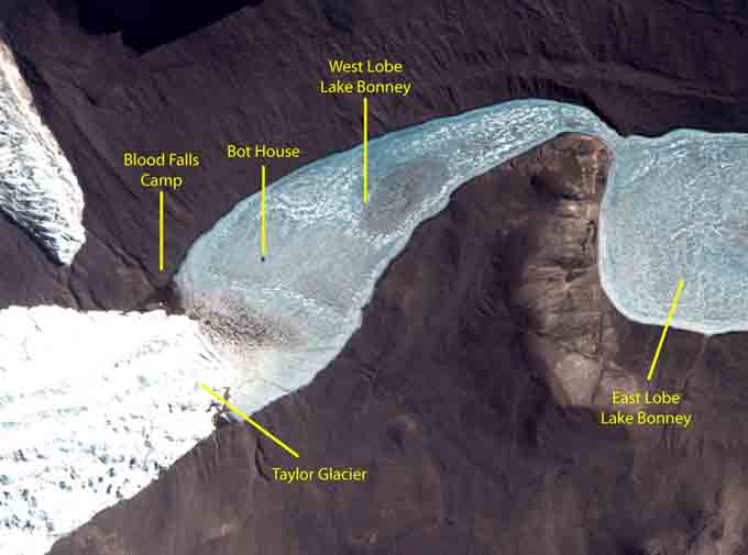
A Quickbird satellite image taken recently shows our camp and Bot House on West Lobe Lake Bonney.

Reporting by Vickie Siegel

December 10, 2008 By Stone Aerospace

ENDURANCE: Mission 1: December 10, 2008

West Lake Bonney, Taylor Valley, Antarctica
Reporting from Blood Falls Basecamp

Back in business with our repaired profiler, today we planned our first drop sonde mission. With Bill and Vickie waiting outside to track the bot from the ice surface with the loop antennas, the crew at mission control sent the bot under the ice on its first real data collection mission. We were done with all of our preliminary check-out tests and now its time to do some science. The idea of the drop sonde missions is this: We have made up an imaginary grid over the whole lake. The lines of grid are spaced apart by 100 meters in the x direction and 100 meters in the y direction. Every spot where two grid lines cross is a point where we want to get water chemistry measurements. To get these, the bot navigates at a depth of 1 meter below the ice ceiling to a grid point in its mission plan. When it reaches the point it floats up until the four feet at the top of the bot rest against the ice, a maneuver we call ice-picking. Once the bot is ice-picked, it is stable and begins to lower the sonde. The instruments on the sonde take measurements of the water chemistry and so on as the sonde reels out. The sonde stops lowering at a distance of 1 meter from the bottom, takes a photo of the bottom and then the sonde reels back up. While the bot is ice-picked and dropping the sonde, Bill and Vickie locate the bot’s position from the surface and mark the spot with a flag. At the end of the day, Maciej uses a GPS to get a coordinate for each flag. We can compare these coordinates showing where the vehicle has actually traveled to where the computer’s mission log says it has traveled. This is a double check for our navigation and assures Peter and John that we have an exact and accurate location for the instrument measurements we’ve taken.

Vickie prepares the flags that will be used to mark the locations of the sonde casts.

For our first data run, everything went incredibly smoothly. Bill, Peter and Vickie tracked the bot on the surface and watched as the flags marking the grid points lined up in 100 meter intervals. The folks at mission control found that things were going so well that we still had enough battery power to do an extra point on the way home. This gave us a total of eight sonde casts for the day, a very satisfying start to our scientific work at the lake.

Peter marks the location of our first data point!

On the bot’s way back to the melt hole after the sonde casts, Kristof took the opportunity to troubleshoot some problems he had been having with the USBL. The USBL is one of the bot’s navigation tools and there are two parts to it, the large transceiver is mounted to the vehicle and the 30 cm long transponder hangs down in the melt hole. It is kind of like a homing beacon: transponder sends out a signal, the transceiver picks up that signal and can then calculate the distance and bearing to the transponder. It feeds that bearing and distance to the bot and the bot uses it to help navigate home. For the past few days we had not been able to get it to work; the transceiver was not receiving the transponder’s signal, but after some experimentation today, we found the best depth at which to hang the transponder, and now that system is working.

John adjusts the depth of the USBL transponder.

Chris downloads our first lake data from the Seabird instruments at the end of the day.

Our status at the end of the first profiler mission.

Reporting by Vickie Siegel

December 9, 2008 By Stone Aerospace

ENDURANCE: Mission 1: December 9, 2008

West Lake Bonney, Taylor Valley, Antarctica
Reporting from Blood Falls Basecamp

Thanks to Bart’s long night with the servo driver electronics, we were ready to test the fix this morning. We hooked the pod, with electronics still exposed, to the bot and ran some tests in air to see if everything was functioning normally. Once we saw that the profiler drum was spooling out and winding up as directed we sealed the housing back up and spent a few hours remounting it into the bot. Now it was time for the real test—putting it back in the water. We lowered the bot nervously. Every time we open an electronics housing we run the risk of scratching the pod’s sealing surface or pinching an o-ring. Either mistake will allow the pod to leak, an obvious catastrophe. We were relieved, therefore, when the leak detector board in the pod showed normal data, no leaks. Even better was the news that the profiler was working, even after it had cooled down. We weren’t getting any temperature faults. Another hurdle is out of the way.

Bart and Bill test that the profiler is spooling cable in and out properly. The open profiler electronics pod is sitting on wood blocks between them.

Reporting by Vickie Siegel

December 8, 2008 By Stone Aerospace

ENDURANCE: Mission 1: December 8, 2008

West Lake Bonney, Taylor Valley, Antarctica
Reporting from Blood Falls Basecamp

With yesterday’s success and some navigation data for the programmers to occupy themselves with, today seemed like a good day to work on the problem with the profiler. Through some research, Bart had established that there was a thermistor in the servo driver electronics that would trigger a fault at temperatures around freezing. This seemed like a strange design because the usual concern with electronics is that they will overheat and fail, so having a maximum temperature cutoff makes sense. At our temperatures, though, the electronics will still work fine and there is no real reason to trigger a fault. There are several ways to get around this problem and all of them involved getting into the driver’s electronics. What Bart decided to do was to replace the thermistors with a fixed value resistor.

The first step of this repair was to remove the housing that contains the profiler electronics. Unfortunately, this is not easy. Of all of the housings we might need to open, the profiler electronics pod is in the physical heart of bot, buried in cables, metal frames, pulleys and so on. We had to remove the drop sonde from its cable, remove the pulley, and undo dozens of nearly-impossible-to-reach bolts. To everyone’s surprise, we had the pod out in only two hours.

Here is the pod we have to remove, right in the center of the vehicle.

Bart slowly slides the electronics pod and pulley assembly out of the vehicle.

Bill and Bart inspect the pod after we’ve detached the pulley assembly.

Pulling the pod out of the bot was only the beginning of the process. Once we had opened the pod, it took Bart several more hours to meticulously remove the electronic components that blocked his access to the servo driver electronics, where he needed to work. He decided that the easiest fix to our temperature fault problem was to spoof the firmware temperature fault control so that it would never trip off. He did this by soldering a standard value resistor in series with the thermistor that had been built into the driver by the manufacturer. A thermistor is a like a temperature sensitive resistor. At lower temperature it provides less resistance and at higher temperature it provides more resistance. Placing another resistor in series with the thermistor adds to the total resistance “felt” in that part of the circuit. Since the firmware equates higher resistance to higher temperature, it is fooled by this new high resistance to think that the temperature is higher than it really is and it doesn’t trip the fault.

Bart works late into the night opening up the pod, digging through the layers of electronics and soldering in the resistors.

It’s good in theory, and we all hope it’s going to work.

Reporting by Vickie Siegel

December 7, 2008 By Stone Aerospace

ENDURANCE: Mission 1: December 7, 2008

West Lake Bonney, Taylor Valley, Antarctica
Reporting from Blood Falls Basecamp

Today we decided to spread our wings a little bit and try a longer run. We had two goals to start with. The first was to make sure the navigation really is rock solid even over long distances, and the second was to try to find another piece of lost equipment that Peter thought might be waiting to snag us. These goals would take the bot 380 meters from the melt hole, which is actually the farthest we’ve ever sent the bot away from mission control, even including all of our previous tests in the States and the DepthX missions in Zacatón. In preparation for this rite of robot passage, Vickie swapped out the 400 meter long fiber optic line we had been using up to now for a 1000 m line. While normal fiber optic would sink and droop down to the halocline in Lake Bonney, this fiber optic has a special coating that allows it to float up to the ice ceiling. This way, when the bot spins in a circle or lowers the sonde, it won’t get wrapped up in the fiber.

Vickie unspools the kilometer-long fiber optic in preparation for the bot’s380-meter journey away from the melt hole today.

A destination point was entered into the bot’s navigation system and Endurance motored off while Peter, Bill, and Vickie tracked it from the surface. The target was the last known GPS location of an old ablation stake (essentially an ~8 meter long rod used to measure how much the lake ice ablates over time) that had disappeared into the ice in a previous year. Peter said there was a small chance that the stake could be sticking straight up out of the lake sediment and might serve as a fiber optic snag if we didn’t check it out first.

Vickie tracks the bot’s magnetic beacon using a loop antenna.

The GPS point we had turned out to be inaccurate by several meters but there was also a flag marking the spot on the surface so, since we were able to locate the bot from its magnetic beacon, Bill was able to report a heading and distance to Shilpa, Kristof, and Chris at mission control, and they were able to drive right to the spot, confirming that both navigation and beacon were working correctly. A wrench securely tied to some rope had been lowered down a small melt hole at the target so that, looking from the forward-looking camera, mission control would be able to confirm that they reached the spot. Reach it we did, and we proceeded to investigate the area, spinning the vehicle and using the forward-cam to look for the missing ablation stake. After some time spent hunting for the stake we decided to bring the bot home for the final test of the day: visual homing.

This image comes from the bot’s forward-looking camera. When we saw the wrench in the field of view,we knew that we had reached the flagged point on the surface successfully.

One of the interesting technological problems with working under a 3-meter ice cap is the question of how to get a 2 m x 2 m bot covered with delicate instruments back out of the melt hole you tossed it into. Coming from the DepthX project, we knew that the bot’s dead-reckoning navigation was quite good and could get us back to within a few meters of the melt hole. But short of manually driving the vehicle up the 3-meter tall melt hole, how could we get it to ascend at the right time? The answer was machine vision. We have an upward looking camera on the bot and above the center of the melt hole we have a 12 watt LED light that blinks on and off at a specific frequency. Shilpa worked with Aniket and Greg, two Stone Aerospace programmers back in Austin, to write a visual homing program that would start up when the bot approached the melt hole. It would use the camera to identify all of the light sources above it, pick out the bright light that blinked at the right frequency, lock onto that light, and then kick in the appropriate thrusters to center the vehicle under the light and follow it up to the surface. That is, if it worked.

We had tested the visual homing in our final bot tests over the summer and it appeared to work well in the wide open waters of NBL’s brobdingnagian tank. However, we had never been able to test how it would perform in a tall, narrow tube like the melt hole, where the consequences of running just a little off course meant hitting the wall. Shilpa urged us all to have faith in the program as we leaned over the railings around the melt hole, looking down and waiting for the bot. The orange edge of the bot’s syntactic became visible in the southwest quadrant of the melt hole. It started to pass under the hole, still under normal navigation. The regular pulse of the blinking light flashed off the water surface onto our faces. As the bot passed under the hole it stopped, shimmied a little to one side and then to the other, centering itself before ascending gracefully up the hole. The skin of the syntactic broke the surface of the water and the whole room cheered. Not only had the bot navigated to a target 380 meters away under a 3 meter ice cap, but it came home and, using the visual homing, popped straight up to the surface like all good robots should. We are beginning to feel like all of our hard work is paying off.

Video, recorded by the bot as it approached and ascended the melt hole:The bot moves along under the ice; the string wiggling above the camera is the fiber optic line.It reaches the edge of the melt hole, identifies the blinking light, locks onto it and ascends to a cheering crowd.

Reporting by Vickie Siegel

« Previous Page
Next Page »

Footer

Corporate headquarters:
Austin, Texas

Smart tools for exploring the frontier
  • Facebook
  • Instagram
  • LinkedIn
  • Twitter
  • YouTube

Copyright © 2026 · Stone Aerospace, Inc.