• Skip to main content
  • Skip to footer

Stone Aerospace

Smart tools and systems for exploring the frontier

  • Home
  • About us
    • What we do
    • History
    • Design philosophy
  • Projects
    • BEAGLE
    • PARTI-Pucks
    • Thor
    • PROMETHEUS
    • ARCHIMEDES
    • ARTEMIS
      • Description
      • Field notes
      • Photo gallery
    • VALKYRIE
      • Description
      • Field notes
      • Photo gallery
    • ENDURANCE
      • Description
      • Field notes
    • DEPTHX
      • Description
      • Field notes
  • News
  • Employment
  • Contact us
  • Stone Aerospace in One Page

ENDURANCE

November 11, 2009 By Stone Aerospace

ENDURANCE: Mission 2: November 11, 2009

West Lake Bonney, Taylor Valley, Antarctica
Reporting from East Lake Bonney Basecamp

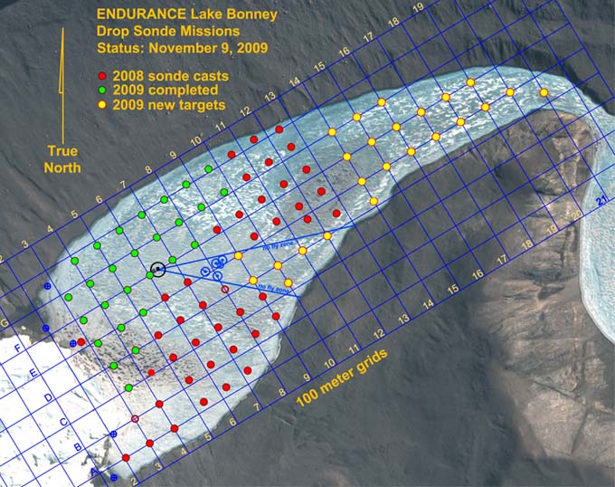
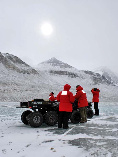
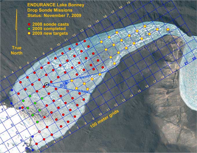
Today was to be the first long range mission, going 300 meters further east than we had reached in 2008. In preparation for this we re-spooled a new 2 kilometer data fiber we had commissioned for 2009. This, plus mission planning and software upgrades keep everyone busy until 2:45pm when the mission got fully underway, targeted at achieving 19 sonde drops. We had sunny weather with a persistent 10 knot wind coming up the valley from McMurdo Sound.

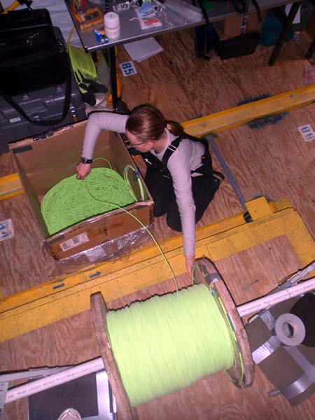
Vickie “flakes out” the 2 kilometer data fiber spool so that it will deploy without hockling (a tendency of coiled ropes, fibers, and cables to form loops).

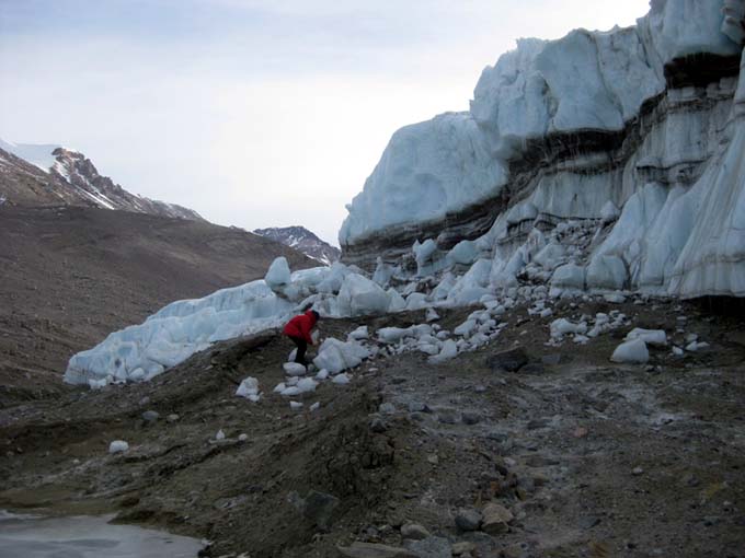
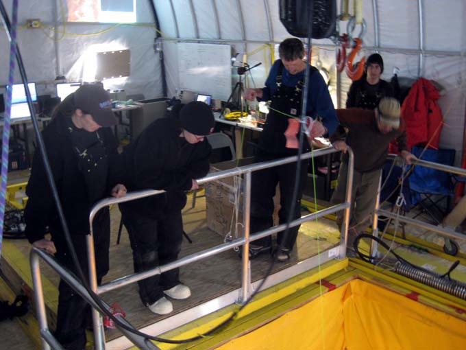
We had already logged the first sonde cast (F10) and were localizing the vehicle at G11 when at 4:45PM mission control called to indicate communications went down on the bot. The team at mission control tried rebooting; changing the short fiber from the main targeting computer; changing the fiber optic to Ethernet conversion boxes, but no go. They then began pulling fiber in to test if communications would come back—due to a kink straightening out—but also no go. So Bart and Kristof began pulling it back using the fiber with a slow, steady 2 kilogram force—enough to gently get it moving under the ice cap. Vickie and Bill tracked it for 50m to assure it was pulling straight back towards the bot house before packing up and returning the remaining 400 meters on foot. The vehicle was in the middle of a sonde caste when the communications had gone dead so it was unclear whether the sonde mission completed and the instrument package homed to the bot.

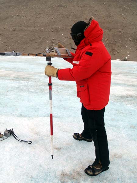
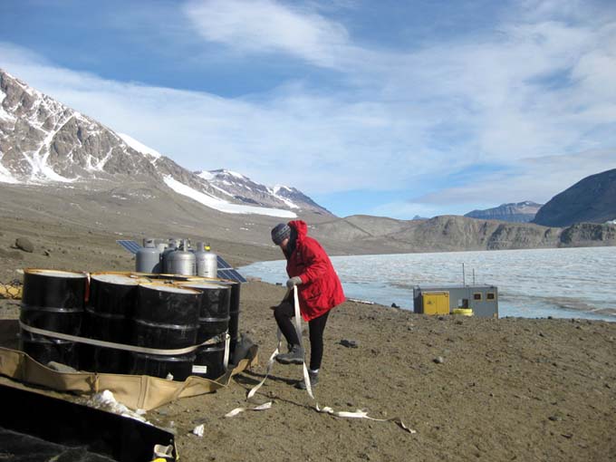
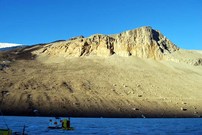
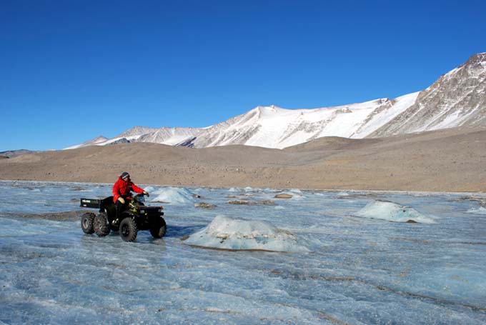
Bill operates an instrument for measuring the surface albedo at station F10. These data will be used to cross correlate PAR (photosynthetic active radiation) readings from the vehicle sonde sensors with surface illumination.

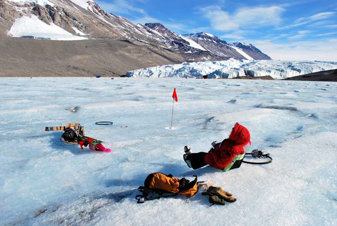
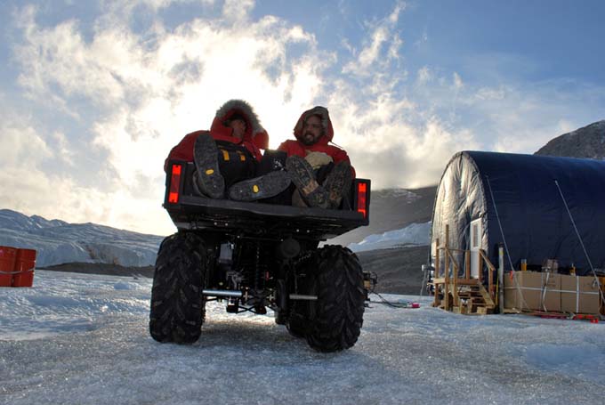
Vickie grabs a quick bite of lunch while waiting at station G11 for a decision from Mission Control (450 meters away towards the glacier) on the status of the vehicle.

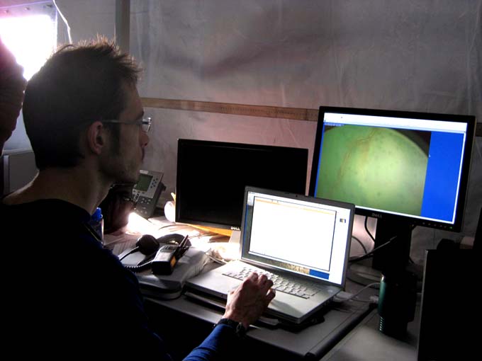
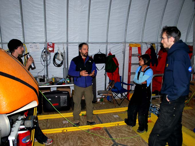
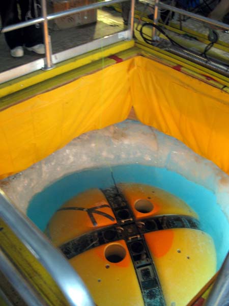
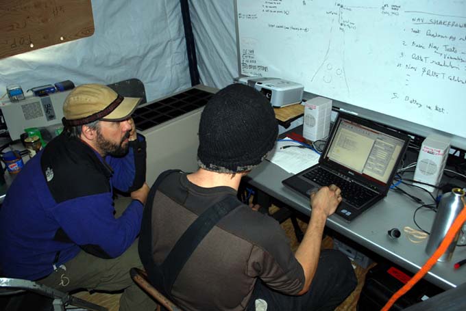
The vehicle successfully returned to the melt hole at 7:44pm, whereupon an extensive investigation began that would last another day. It was floating neutrally in the water, an important sign that there had been no housing leaks. We made a direct fiber optic connection (bypassing the 2 kilometer spool) but still no connection. Similarly, a wireless link that was activated when the bot was out of the water also would not work. We discovered when the bot was hoisted out of the water that the sonde had not reeled back in—indicating a significant communications problem had affected all systems at once. Vickie connected a diagnostic serial communications cable directly into the Profiler housing and Chris was able to verify that the bot had significant reserve power and was responsive to direct local commands—and we thus respooled the sonde—about 26 meters had been paid out at the time of failure. Further investigations through other independent instrumentation data ports showed that the main processor stack data router was down. We were able to talk to the cameras and several other key instruments but it was the main processor stack that issued commands to operate the various parts of the vehicle. The batteries had more than 50% power remaining. An independent test of the 2 kilometer fiber showed that to be operating as expected.

At 9pm we recycled vehicle power and the wireless link came up temporarily then crashed. We then opened up the main processor housing. There were no “smoking guns” that would suggest a shock-induced failure (e.g. a loose connector from impacting the underside of the ice during ice picking). We held a team meeting to discuss and the general consensus was that oxidation on wires from internal power supply to router may be the problem—will investigate tomorrow.

Reporting by Bill Stone

November 10, 2009 By Stone Aerospace

ENDURANCE: Mission 2: November 10, 2009

West Lake Bonney, Taylor Valley, Antarctica
Reporting from East Lake Bonney Basecamp

This was a day off. Most people were up at 1:20pm, after having gone to bed around 3am after downloading all the data and cleaning up from the late mission of November 9. Most people wrote blog entries and sorted photos. Kristof and John Priscu collected “glacier berries”—small chunks of ice that had broken off Taylor glacier—and hauled them back to camp in a sled behind their ATV. This has been our main water source.

John Priscu collects fallen blocks of ice for our drinking water from Taylor glacier.

Today was also a whirlwind of helo activity here with carpenters coming in from McMurdo to work on basecamp improvements and PIs (“Put Ins”) of empty wastewater barrels and removal of full ones. Items to be “retro’d” (returned to McMurdo) had to be loaded into cargo nets for sling loading beneath a helicopter. A typical load is seven 55 gallon drums or a similar number of loaded propane tanks. A total of four flights landed here today.

Kristof brings and empty wastewater barrel to the Jamesway hut. Everything from dish and washwater to urine goes into these barrels.

Emma Steger prepares a 7 barrel sling load of wastewater to “retro” to McMurdo.

Reporting by Bill Stone

November 9, 2009 By Stone Aerospace

ENDURANCE: Mission 2: November 9, 2009

West Lake Bonney, Taylor Valley, Antarctica
Reporting from East Lake Bonney Basecamp

The bot was in the water at 11:30am. Around an hour later it was apparent that there was a navigation error which was being manifested as a scaling and rotation error. We subsequently drove the vehicle to stations F5, F4, and F3 which showed a straight line at about 95% scale and rotated 8 degrees counterclockwise from the accurate data from two days ago. We returned the bot to the lab and GPS-located the achieved stations targeted at F5, F4, and F3.

Kristof soon realized that the navigation correction transform obtained from the 2009 calibration had been accidentally applied to the previous 2008 corrections so we had been doubly correcting. We made the correction but decided to put the vehicle on charge for an hour to make up for the lost power before re-starting today’s mission. We were back in the water at 3:30pm.

Ultimately this was a 19 point sonde mission. We started off swiftly with F5,G5,G4, G3, H4, H5 then encounterd a data fiber snag when returning from the closest approach to the glacier—probably from the same type of pressure cracks and bulges that had plagued the previous mission. We modified the mission to go to G6 whereupon the fiber pulled free. The remaining stations—H6, G7, H7, H8, H9, H10, G10, G9, G8, F8, F7, F6—proceeded without issue.

View of the lake bottom at station H4 showing microbial mats.

View of the lake bottom at station H8 showing a strange reddish deposit—probably iron leaching out of the mud.

In Mission Control, Kristof monitors the live video feed coming from the sonde camera.

At this point we had 32% remaining battery power (about what we had originally wanted to return with… leaving about 10% safety margin to work with above the level where the mysterious power failure had occurred on the previous sonde mission. The actual usable power currently seems to be around 48 to 50 AH relative to last year’s 30 AH max. We expect that another 20% power is being “stranded” due to internal cell power imbalance and plan to investigate this further.

The vehicle was moving at an average of 0.26 m/s for most of the mission and so we were back to the bot garage by 9:40pm—about 6 hours and 40 minutes on the actual mission, including 19 sonde drops. This would have been equivalent to conducting two missions last year in the time of one. Emma Steger kindly brought dinner up at around 10:30pm so we all just kept working. After the vehicle successfully auto-returned to the melt hole we ran it on additional 50m laps centered on the melt hole until the batteries finally died again at around 20% calculated state of charge. The issue appears to be that the lowest cell in one stack is sufficient to drop the battery (safety circuitry cuts it out if even one cell goes low). We plan to disassemble the stacks and investigate when time permits.

Sonde cast progress as of November 9, 2009 (green circles).

Frontice precipice about halfway up Mount JJ Thompson at 1am on our way home. The lighting angles in Taylor Valley are consistently striking and distinctive—since we have 24 hour daylight here the only way to tell the time of day without a watch is to observe where the shadows are and what peaks are lit.

Reporting by Bill Stone

November 8, 2009 By Stone Aerospace

ENDURANCE: Mission 2: November 8, 2009

West Lake Bonney, Taylor Valley, Antarctica
Reporting from East Lake Bonney Basecamp

The snow storm went on through the night and into mid-day on November 8. Helo flights were grounded and areas around McMurdo reached Condition 1.

Given the very late finish the previous day most people slept until around 1pm. We left for the lab at 2pm to begin a detailed assessment of the situation that had caused the battery system to shut down at the end of yesterday’s mission. A team meeting was held—always with everyone standing to get to the point—and tasks were assigned.

Chris (left), Bart, Shilpa, and Kristof discuss the chronology of the previous day’s mission. The team holds its meetings standing up—so everyone gets to the point of their thinking swiftly. We hold these meetings as needed, mainly in the morning to define the mission objectives and roles, but as needed for brainstorming and debugging.

Vickie and Bill headed off on an ATV with the GPS equipment to locate all of the surface fixes obtained during the tracking of the vehicle. Bill then reduced these data to calculate circular error probable (CEP) for the re-navigation to the 2008 grid points (the main purpose of this year’s mission is to duplicate last year’s data set to observe temporal change in the lake chemistry). The CEP was 1.92 meters, meaning on average the bot navigated to within that radius of the exact GPS point reached last year for the sonde grid points. Some (perhaps the majority) of this error was related to the method by which sonde points were acquired: the vehicle navigated to the grid point coordinates where it then went into “station keeping” where the thrusters maintained that position horizontally while allowing it to rise until it stabilized against the underside of the ice cap (the vehicle was always ballasted about 400 grams positively buoyant for this purpose). This condition is referred to as “ice picking”. At that point the thrusters would shut down. The vehicle is equipped with ice picking stand-off posts with rounded ends with very low friction resistance. So if there is any gradient to the underside of the ice (which is not uncommon) the bot can slide a meter or more on occasion before coming to rest. Even with this variation, the re-location navigation error was well within the five meter radius defined by the science team (Peter Doran and John Priscu) as being good enough for a match to the previous data set. So yesterday’s data set was good, both from the chemistry information acquired as well as its geo-spatial position.

Meanwhile, Bart, Chris, Shilpa, and Kristof went through a detailed review of yesterday’s onboard data log files to reconstruct the incident. The conclusion, as Bart had hypothesized yesterday, was that the batteries had automatically shut down just as the bot was stopping for a sonde point. The data logs showed clearly that the current draw on the power stacks reached 30 amps on fast stop—this depressed the single cell voltage of the lowest cell in the lithium stack and tripped the first battery safety latch. The second battery, similarly already reduced in power, was then tasked with all the remaining vehicle power load and it also then tripped—at an apparent 20% remaining power. Why there would be additional “stranded” power is a separate issue we will investigate in the coming days. In the meantime, Kristof began writing a current-limiting behavior for starting and stopping on high speed transit. Theoretically the voltage depression spiking will be reduced if we limit the thruster current draw and allow us to utilize closer to 100% of the battery. With the batteries now re-charged the system came up normally with all communications re-established and all sensors working normally. We are planning current-spiking tests following the conclusion of tomorrow’s long sonde mission.

John Priscu (left) and Bart Hogan are bundled up for the drive home after work at 10pm.

The view out our back door—the Matterhorn peak on the north side of Taylor valley,taken from main Bonney camp.

Reporting by Bill Stone

November 7, 2009 By Stone Aerospace

ENDURANCE: Mission 2: November 7, 2009

West Lake Bonney, Taylor Valley, Antarctica
Reporting from East Lake Bonney Basecamp

The morning started off auspiciously enough with bright sun and no wind. We had the bot in the water by 11:30am (getting the pre-dive checklist and nav system alignment completed in under an hour) and successively drove to the navigation waypoints established yesterday. This time Bill tracked the vehicle using the magnetic beacon while Vickie took a GPS fix as the vehicle reached each waypoint along the course (we knew where the bot was going this time and were waiting for it to arrive at each point). The GPS points (the second set in two days) would be used to verify that the navigation system was working correctly (it was).

Sunshine and no wind can sometimes make life outside our remote lab seem pleasant.

Vickie gears up for GPS tracking of the vehicle at the conclusion of the navigation calibration tests. The differences between the actual locations reached yesterday and the originally targeted locations were used to create an adjustment matrix which compensated for any instrumental scaling and rotation errors.

Pressure ridge remnants near Taylor glacier pop up from the ice cap—underneath, we suspect cracks and bulges that snag a data fiber.

When we reached the conclusion of the navigation re-calibration course Emma Steger (our camp manager) met us with a “banana” sled laden with bamboo flags pre-labeled for the upcoming sonde cast mission planned for today. From there we branched southwest to re-target sonde locations achieved in 2008 (each of which was GPS-located in 2008 and these coordinates were then entered into today’s onboard mission so that both year’s data could be geo-registered to the same location). We proceeded swiftly along to points E5, E4, D4, C3, and E3. Before reaching F3 mission control reported a fiber snag somewhere in the loop—probably due to under ice cracks or bulges associated with pressure ridges near the glacier. We then began a series of lengthy evasive maneuvers ending with a return to C3, then to D4, then back to F3, successfully. By this time, having started with only 80% charge on the batteries and having maneuvered an additional 500+ meters we were beginning to run low on power and decided to return home, stopping at F4, F5, and F6 on the way. We got the sonde drop at F4 but as the vehicle was slowing down at F5 all communications went dead. All attempts to resurrect it electronically failed so we resorted to reeling it in—slowly—using the data fiber. The vehicle is designed for “ice picking”, using rounded posts for contacting the underside of the ice sheet, so it has very low friction resistance to horizontal motion. Provided we encountered no further ice cracks or bulges recovery using the data fiber is straight forward, but slow… about 5 to 10 meters per minute.

Following a non-recoverable communications link failure to the bot the team slowly retrieves it by tugging on the data fiber.

The prodigal bot returns safely.

With the vehicle back we began a post-mortem and discovered that the redundant batteries had both tripped around 20% power reserve. An analysis of the time-domain response of the voltages, however, showed the cause: we had been moving at high speed (twice that of last year) and the sudden stopping to acquire a sonde cast caused a current spike to the thrusters which depressed the battery voltage… enough that one cell in each of the large lithium stacks went below its safety threshold and the auto-disconnect kicked in. By 11pm we had diagnosed the problem and had developed a plan for resolving it. By 12:30am we were packed up and ready to head home… and into an approaching snow storm.

Chris and Bart ponder the power-time history of the mission, looking for clues.

As if the stars were completely mis-aligned this day, the Hotsy melter system—which we had to run in the melt hole each night in order to keep the hole from re-freezing—died, and another hour was spent in the cold. Post-mission discussions lasted till 3:30am. It was a long day in Antarctica.

Bart, Maciej, and John Priscu work on the dead Hotsy. Repairing equipment in the field is the nature of work in Antarctica.

And then the storm hit…

Sonde casts achieved on November 7 (green circles).

Reporting by Bill Stone

« Previous Page
Next Page »

Footer

Corporate headquarters:
Austin, Texas

Smart tools for exploring the frontier
  • Facebook
  • Instagram
  • LinkedIn
  • Twitter
  • YouTube

Copyright © 2025 · Stone Aerospace, Inc.